Vayu morphs into tropical cyclone, Karachi heatwave to push ‘feels like’ temperature to 47-50°C
Vayu, now a severe tropical cyclonic storm, will likely cut off Karachi's sea breeze, worsen heatwave, and bring sandstorm with light rain
June 12, 2019
KARACHI: Cyclone Vayu, upgraded to Category-1 earlier on Wednesday, has now transformed into a tropical cyclone, worsening the heatwave in Karachi and pushing the mercury forecast to hit 39-42°C.
It is noteworthy, however, that the ‘feels like’ temperature could shoot to 47-50°C owing to Karachi's humidity while the heatwave in the port city — as well as in the entire Sindh province — is expected to continue on till June 16, the Pakistan Meteorological Department (PMD) said.
While the sea breeze, too, is predicted to remain cut off, a sandstorm with a touch of light rain is expected in Karachi tomorrow (Thursday), it added. The PMD said the effect of Cyclone Vayu would be limited to India's Gujrat but was expected to hit its shore in the evening tomorrow.
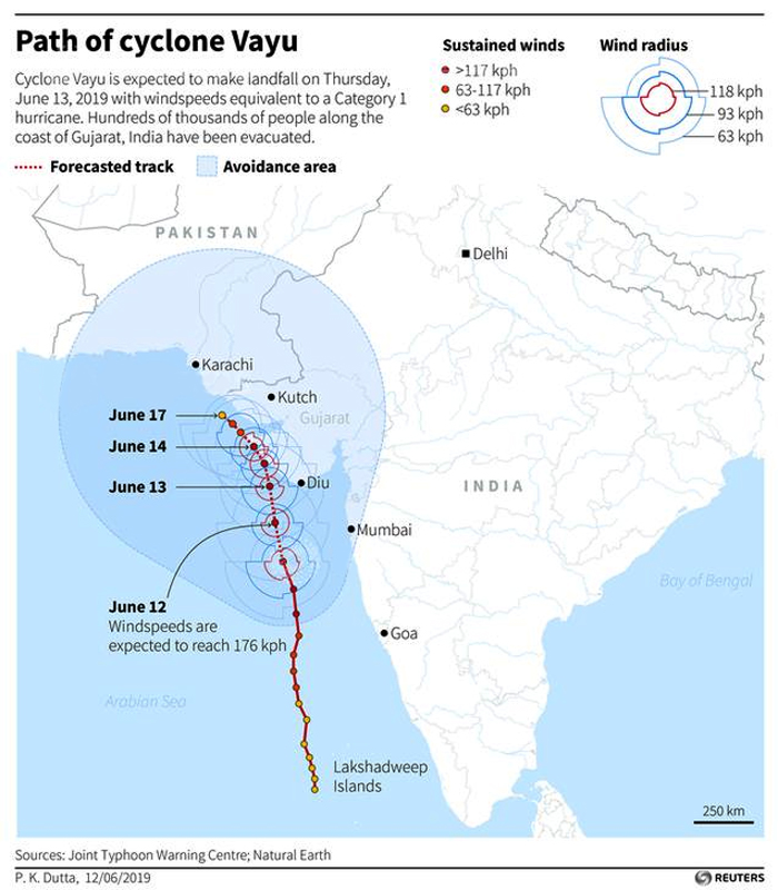
Barrelling towards western India and now classed as a very severe cyclonic storm, Cyclone Vayu has strengthened and is packing gusts of up to 170 kilometres per hour (105 mph), as per forecasters. Gujarat authorities were, meanwhile, trying to evacuate close to 300,000 people living in coastal areas.
"Many people living near the coast are not willing to shift and leave their homes. Our officers are trying to convince them," Ajay Prakash, a local official, told AFP.
"Hopefully, we will be able to shift them in time," the official added.
The coast of Gujarat is also home to two major ports, Deendayal and Adani in the Gulf of Kutch, as well as the Jamnagar oil refinery — the world's largest.
All ports in Gujarat halted the berthing of vessels from Wednesday. Cyclones, however, are relatively rare in Gujarat. The worst was in 1998 when more than 4,000 people perished, according to official numbers.
Separately, the India Meteorological Department (IMD) said winds of between 155-165 kph were expected with gusts up to 180 kph, equivalent to a Category 1 or 2 hurricane.
The IMD also forecast waves of 3.5-5.3 metres (11.5-17.4 feet) over the next two days, with fisherfolk told not to venture out to sea.
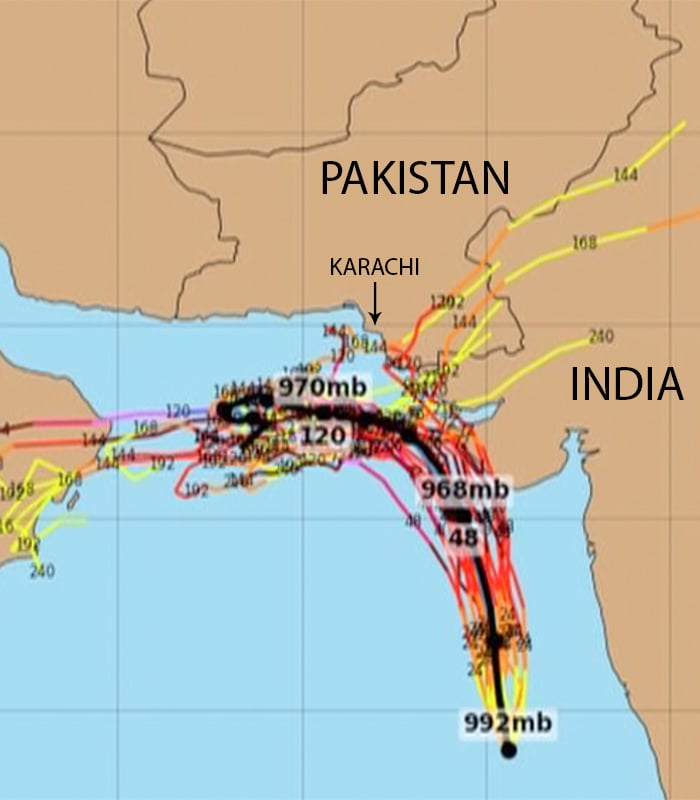
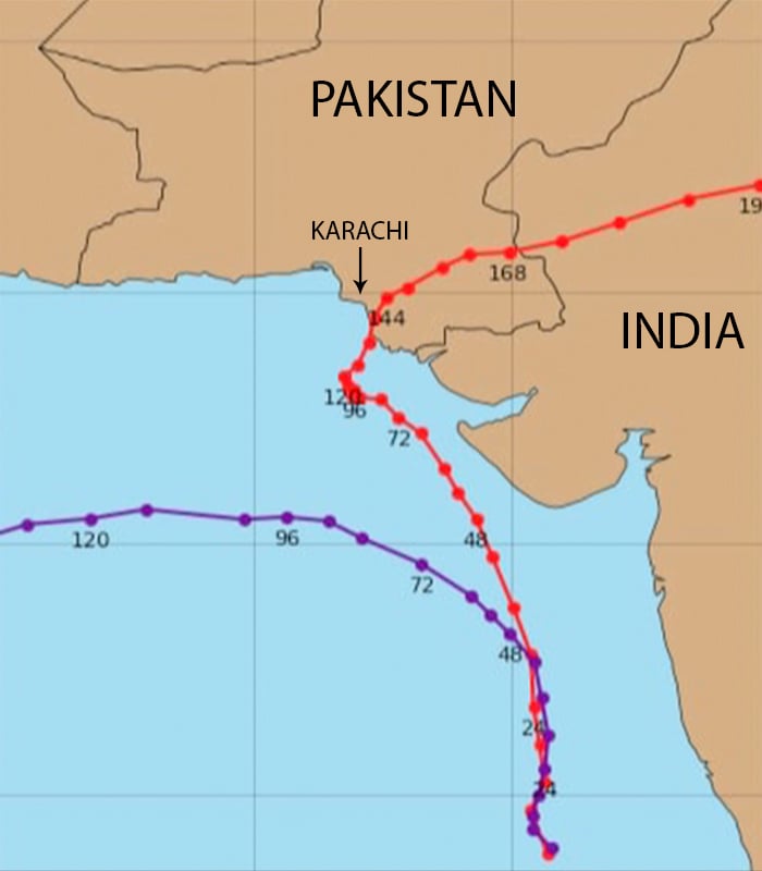
Check out a forecast of Cyclone Vayu's path at the end
On the other hand, there is no threat imminent from Cyclone Vayu for Karachi's coast for the time being; however, the metropolis' maritime boundary may experience flooding and waves can go as high as 12 feet.
It was in this regard that fisherfolk have been advised to return to land and, given the timely warning issued earlier, have already started doing so.
The latest weather system was also expected to draw moisture away from much-needed annual monsoon rains.
Earlier, Cyclone Vayu was upgraded to Category-1, with rain and thunderstorm expected in Badin, Thatta, and Tharparkar districts of Sindh.
The weather forecasting authority had said: “Tropical cyclone Vayu in the East Arabian Sea has intensified as 'very severe cyclonic storm' and moved further north-northwestward during last six hours, now lay centered around Lat.18.N and Long.70.0E at 0800PST at a distance of about 725 km southeast of Karachi.
"The maximum sustained surface winds are 135-145 km/hour gusting to 160 km/hour around the system centre,” it had added.
It explained further: "Vayu is likely to continue to move in northerly direction. Under the influence of this system, widespread dust and thundershowers with scattered heavy to very heavy falls are expected in southeast Sindh (Thatta, Badin and Tharparkar districts) on Thursday and Friday.
Sea breeze was likely to remain cut off on Thursday and Friday (June 13-14) and may possibly lead to heatwave-like conditions in coastal areas of Sindh, including Karachi, the PMD said.


