6-magnitude earthquake rocks parts of country
Tremors were felt across Rawalpindi, Islamabad, and parts of Khyber Pakhtunkhwa; no immediate casualties or damages reported
May 28, 2023

- No immediate casualties or damages reported.
- Tremors felt across Rawalpindi, Islamabad, and parts of KP.
- Quake sends seismic waves to China, Afghanistan and India.
ISLAMABAD: A strong earthquake of 6.0 magnitude jolted parts of Pakistan, confirmed the National Seismic Monitoring Centre (NSMC) on Sunday, with no loss of life so far.
The tremors were felt across Rawalpindi, Islamabad, Attock and parts of Khyber Pakhtunkhwa and Kashmir, prompting people to rush out of their homes and high-rise buildings in panic.
The seismic waves spread to Punjab's Lahore, Jhelum and Chakwal as well.
As per the US Geological Survey, the quake's magnitude was 5.2. However, NSMC confirmed it was 6.0.
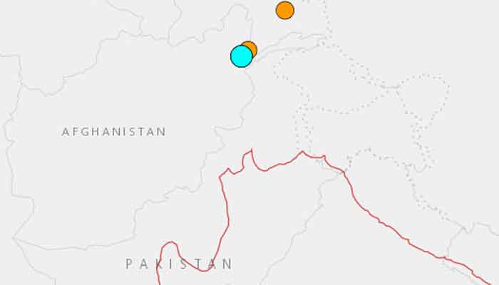
Details reveal that earthquake occurred at 10:50am and the epicentre of the earthquake was located in the border region between Afghanistan and Tajikistan.
Meanwhile, the depth of the quake was 223km deep, which is why it was felt in several countries including Pakistan, China, Afghanistan and India.
It should be noted that no immediate casualties or damages were reported in the aftermath of the quake.
Natural disasters such as earthquakes are not uncommon in Pakistan, as the country is situated on the boundary of the Indian and Eurasian tectonic plates.
Large parts of South Asia are seismically active because a tectonic plate known as the Indian plate is pushing north into the Eurasian plate.
Recent earthquakes underscore the importance of disaster preparedness and mitigation measures.


